Our meeting point Wiehre station may be reached by train or car (free parking available, numbers limited). Other meeting points upon request. Pick up service available for tours outside of Freiburg.
13 km single trails, few streets, 200 m of elevation gain, 55 - 75 min, moderate: Schwabentorbrücke, Wiehre Station, Wasserschlössle, Waldsee, St. Ottilien, Kanonenplatz, Schwabentorbrücke
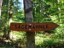
13 km single trails, few streets, 200 m of elevation gain, 55 - 75 min, moderate: Schwabentorbrücke, Wiehre Stat., Wasser-schlössle, Waldsee, Brombergsattel, Sägemännchenweg, Waldsee, Schwabentor-brücke
13 km single trails, few streets, 200 m of elevation gain, 55 - 75 min, moderate: Schwabentorbrücke, Kanonenplatz, the area underneath Roßkopf up to St. Ottilien and Sport-Uni, possible along Dreisam Creek back to Schwabentorbrücke
9 km trails, 400 m of elevation gain, 60 - 90 min, very intense: Schwabentorbrücke, Kanonenplatz, top of Roßkopf and back down
16 km trails or narrow forestry roads, 300 m of elevation gain, 2 hrs., moderatedemanding, nice views, recommended for August/September!: to starting at Notschrei the cross country skiing loop Schauinsland to Köpflesbrunnen with view to Belchen, Wiedener Eck and Todtnau, back (attention: 30 min ride to trail head)
25 km moderate trails, forestry roads, asphalted bike paths, 2.5 - 3 hrs., moderat to demanding: Schwabentorbrücke, Wiehre station, Wasserschlössle, Waldsee, St. Ottilien, on the Querweg to Stegen, back along Dreisam Creek through Dreisam Valley to Schwabentorbrücke. Good for marathon preparation.
26 km trails, 1000 m of elevation gain, 3.25 hrs., very demanding, nice views: Schwabentorbrücke, Wiehre station, Kybfelsen, Schauinsland with view to Feldberg, back
27 km trails, 1000 m of elevation gain, 3 hrs., very demanding, nice views: Schwabentorbrücke, top of Roßkopf, St. Peter, Kandel, Waldkirch, back by train
28 km trails, 800 m of elevation gain, approx. 2.5 hrs., demanding: Schwabentorbrücke, Kanonenplatz, top of Roßkopf, on forestry roads and trails to Heuweiler (North of Freiburg), like an 8 back to Roßkopf and returning to Schwabentorbrücke. After reaching the top of Roßkopf, we cover the course of the Roßkopflauf.
30 km, 700 m of elevation gain, 3 hrs., very demanding: Schwabentorbrücke, on Querweg to St. Ottilien, Stegen, Hinterzarten, upon request continuing to Titisee, back by train
35 km, 600 m of elevation gain, 3.25 hrs., demanding, nice views: Schwabentorbrücke, Roßkopf, St. Peter, back


